10 Heavenly Hikes West of the Continental Divide
What to do in Montana...
Nothing inspires like the high country, standing with a sweaty sheen and a silly smile after conquering a challenging trail. West of the Continental Divide, serious hikers can experience Big Sky bliss on the state’s most rugged ascents and test themselves on some of the best trail adventures in North America. The vistas are not only spectacular, they stretch from the brilliant blue of Montana sky to glassy alpine lakes and distant pincushion forests of green. Put these 10 picks for memorable hikes on your Montana bucket-list!
Antone Peak
Level of Difficulty: Strenuous to Antone Peak and Easy to Antone Pass
Length: 5-mile round trip; out-and-back
Trailhead: 40 miles southeast of Dillon in the Snowcrest Range
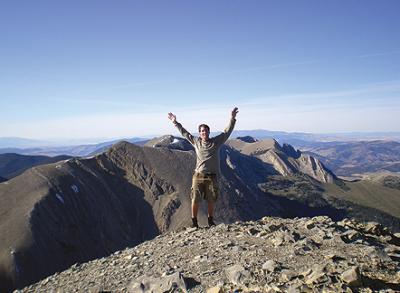
The Meadow Creek Trail to Antone Pass, 40 miles southeast of Dillon in the remote Snowcrest Range, is heavily marked by trail markers, rock cairns, and blazes along the left side of the meadows. As the blazes and rock stacks cease, look uphill and to the left, up the ridge. The trail sinks into the bowl below Antone Peak. It’s a strenuous 1.5 mile climb up this bowl to the 10,247-foot summit of Antone Peak. The panorama here includes the rest of the Snowcrest Range stretching off to the north, the expanse of the Red Rock Valley, and the Centennial Mountains on the southern sphere.
Akokola Lake
Level of Difficulty: Moderate
Length: 11.6 mile-round trip; overnighter or out-and-back
Trailhead: 35 miles northwest of Columbia Falls in the North Fork Region of Glacier National Park
The North Fork of the Flathead River outlines the western boundary of Glacier National Park. Inside the park several lakes drain into the river, with Akolola being one of the smallest. This hike extends through typical North Fork country, with lodgepole pine forests and rolling ridges, but without the snowcapped crags found elsewhere in the park. Don’t forget you are deep in Glacier Park grizzly territory, so be hyper-vigilant about every possible bear country precaution and sanitary rule.
Great Northern
Level of Difficulty: Very Strenuous
Length: 8-mile round-trip; out-and-back
Trailhead: 30 miles east of Kalispell in the Great Bear Wilderness.
Although named for a former railroad, the moniker of the mountain suggests exactly what it is. Its graceful arcs and broad faces are irresistible to the individual who has acquired a taste for lofty places. Even with the incomprehensible peaks of Glacier National Park nearby, this mountain attracts many climbers solely on the virtues of its beauty and isolated splendor. This is a difficult route suitable only for backcountry hikers with strong GPS and off-trail mountaineering skills.
Illinois Peak
Level of Difficulty: Easy to Moderate
Length: 10-mile round-trip;
out-and-back or overnighter
Trailhead: 45 miles west of Missoula in the Bitterroot Mountains.
Perhaps because the higher segments of the Bitterroot Mountains north of Lolo Pass are not visible from a major highway, they remain relatively unpursued. On a map they are easily overlooked and underrated. None of the peaks exceeds 8,000 feet. At 7,690 feet, Illinois Peak is one of the highest peaks in the northern Bitterroots. The scenic out-and-back trek wends through subalpine country and offers many supreme views,
as does the peak itself.
Lolo Peak
Level of Difficulty: Moderate
Length: 9-mile round trip;
out-and-back or overnighter
Trailhead: 5 miles west of Highway 12 in Lolo.
Lolo Peak is very close to Missoula. Due to that short proximity, Lolo Peak (the northernmost 9,000+ foot high point in the Bitterroots) is one of the most journeyed local peaks. Lolo Peak Trail takes hikers to the crest of Carlton Ridge, part of the cirque that contains Carlton Lake. As you hike you will see the North Summit, the splendid mountain towering above the Missoula Valley to the southwest. It is often mistaken for Lolo Peak, which is hidden and not visible from certain vantages of the valley. Depending on whether you head for the North Summit or Lolo Peak, it is a strenuous 2,900 or 3,300-foot climb. Carlton Lake offers a bevy of well-used campsites. For those who venture onward, the trail is precipitous but the payoff immense: spectacular views into the neighboring Selway-Bitterroot Wilderness and the Missoula Valley.
Mount Aeneas
Level of Difficulty: Easy
Length: 10-mile loop hike; out-and-back
Trailhead: 4 miles south of Jewel Basin and Bigfork Road cutoff.
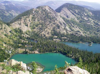
Mount Aeneas is a gorgeous mountain apex in Flathead County, which climbs approximately 7,500 feet above sea level. Thanks to its awesome views, premier mountain goat watching opportunities and mellow tread, Mount Aeneas is an extremely popular destination. Situated in the towering Swan Mountains, Mount Aeneas is one of the easiest summit ascents in western Montana. The 5.9-mile loop trail tops out at 7,528 feet, yielding big views for minimal work. The peak overlooks Jewel Basin, a 15,349-acre hiker-only area holding 27 radiant lakes, and its summit panorama includes Flathead Lake, Glacier National Park, and the Bob Marshall Wilderness.
Northwest Peak
Level of Difficulty: Easy to Moderate
Length: 4.6-mile round trip; out-and-back
Trailhead: 40 miles northwest of Libby
Northwest Peak, elevation 7,705-feet, is the principal attraction of a high mountain ridge, the most striking portions of which are included in the Northwest Peak Scenic Area, an official designation of the Forest Service. The peak is a long drive from almost everywhere except the Yaak Valley, so make sure that the gas tank is full and the food and water supplies are stocked. This area normally gets more than its fair share of snow, so wait until July to conquer Northwest Peak. Northwest Peak is an excellent introductory hike to the backcountry of western Montana.
Stuart Peak
Level of Difficulty: Moderate
Length: 11-mile round trip; out-and-back or overnighter
Trailhead: Follow the main corridor of the Rattlesnake Recreational Area trail 2.5 miles, follow signs at marked junction.
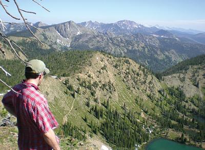
The 61,000-acre Rattlesnake National Recreation Area, part of the Lolo National Forest, is positioned at the northern city limits of Missoula. The beautiful topography features ridges, valleys, peaks, basin lakes, and a diverse array of orchids. The Stuart Peak Trail heads up Spring Gulch parallel to Spring Creek. The Spring Creek Loop follows along well-trodden cow paths and a farm lane, spiraling around both sides of the creek. Spring Creek drains into Rattlesnake Creek, a municipal watershed for Missoula. The Stuart Peak Trail takes hikers into alpine lake country and ends with vistas of surrounding mountain ranges from the top of Stuart Peak. Stuart Peak is 18 miles round trip and is quite strenuous at places. Its uphill gradient is around 4,000 vertical feet. Awesome camping areas exist along the base of Stuart Peak.
Trapper Peak
Level of Difficulty: Moderate Difficult
Length: 8-mile round trip; out-and-back
Trailhead: 10 miles south of Darby turn right on 473, follow the signs to Trapper Peak Trail.
The best times to tackle the beautiful Trapper Peak are from July to September, though perennial packets of snowfall at the summit are not unusual. An early start is suggested, as is an accurate weather forecast and a GPS system. Take plenty of water too, as there are no reliable water sources. The trail starts at the Trapper Peak Trailhead and at 1.6 miles enters the Selway-Bitterroot Wilderness, the wilderness encompassing more than 2,000 square miles of lightly traversed, remote Montana and Idaho backcountry. Elevations within the Selway-Bitterroot wilderness range vary from less than 2,000 feet along the Selway River to the mammoth 10,157-foot zenith of Trapper Peak (the highest point in the Bitterroots). Certain portions of the Trapper Peak Trail are poorly defined, ill maintained, and hard to follow, especially on the return trip. The early segments trudge relentlessly upwards through lodgepole pine, white bark pine, and Douglas fir. During the summer months, thick snowfields still cover much of the upper trail and mountain crest. At the halfway point, the trail wraps northwest and breaks free from the dark forest, leaving the realm of alpine larch and coming to light near the 9,000-foot contour. The last half-mile or so of this hike scoots boulders and rock fields. East of the apex, a massive detachment of Trapper Peak appears, where stacks of rock cairns indicate the true summit. To reach the lofty head of Trapper Peak requires a brief scramble atop huge rocks and stone. At 4.0 miles the trail reaches the summit of Trapper Peak, where a metal register and plaque greet the hearty, exhausted climber.
Ward Mountain
Level of Difficulty: Strenuous
Length: 9-mile round trip
Trailhead: 2 miles south of Hamilton, turn right on Roaring Lion Road, follow the signs to Ward Mountain Trail.
From the floor of the Bitterroot Valley, Ward Mountain looks as tame and gentle as a tittering sea otter, and because it’s so close to the town of Hamilton one might predict it to be unexciting. Once you start hiking the roughly blazed dirt trail, however, the town is seldom seen and the flora, the fauna, and the rocks are lush and fierce, underscoring an impressive and eclectic milieu, more diverse than anything else ready to be found in surrounding canyons. Ward Mountain is one of the steepest trails in the Bitterroot. The trailhead begins at 4,180 feet, with the summit cradling 9,119 feet. Beginning at the southern outskirts of Hamilton, Ward Mountain Trail climbs nearly 5,000 vertical feet in less than 5 miles, reaching a former lookout site at the vertex. Known for its unpredictable weather, it often snows at the summit in July. On a searing summer afternoon, Ward Mountain is extremely oppressive, only appropriate for those in strong physical condition. The hike out can be hard on the knees any time of year. The excellent news, however, is that the mountain is practically free of crowds, and rife with opportunities for solitary adventures, as well as wildlife. Quite possibly the single most exhausting trail in the entire Bitterroot Range, its lofty vantage point spanning the full length of the valley makes the precipitous jaunt worthwhile. Panoramic perspectives include views of the Skalkaho, Roaring Lion, and Sleeping Child drainages.
~ Avid hiker Brian D’Ambrosio is a frequent contributor to Distinctly Montana. His favorite hike is usually the one he happens to be experiencing at the time. He lives in Missoula, Montana.n





Leave a Comment Here