Extreme Weather Events That Contribute to Montana's Reputation For Legendary Winter Weather
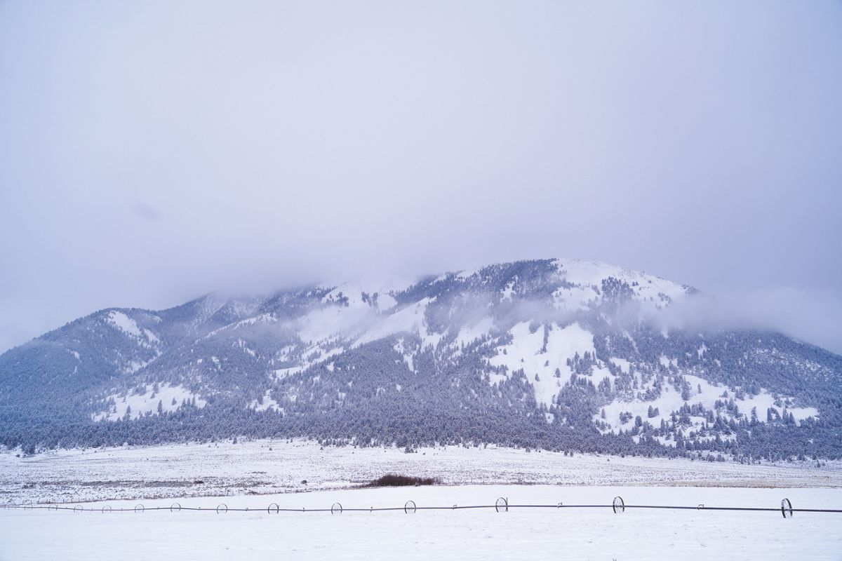
Montana is renowned for its winter weather, a reputation that is punctuated by extraordinarily dramatic events which literally can leave one awestruck by the manifest power of Mother Nature. Indeed, Dr. Kenneth F. Dewey, a retired professor of climatology at the University of Nebraska, states that “nowhere on earth do the conditions necessary for the creation of dramatic weather come together with such severity as they do here, in the American West.”
Consequently, Kevin Conradt makes a compelling argument that it would be more accurate to interpret Montana weather, particularly its winters, as oscillations between extreme weather events, rather than the traditional emphasis on statistically calculated average conditions. Application of this “mathematical bias,” he contends, implies a patently “false sense of environmental stability.”
To illustrate the validity of this perspective, one does not need to turn back the pages of history farther than January 11-19, 2024, when a powerful surge of bitterly cold air descended upon Montana. A graphic posted by the Great Falls office of the National Weather Service indicates that at least 20 observational stations in their monitoring region documented temperature variations for January that ranged from 102 to 115 degrees. All but one of these sites recorded a maximum monthly temperature of 60°F (or higher), and lows ranging from -33°F to -51°F. The Billings office of the NWS similarly confirmed that “January 2024 was the first month on record in which Billings observed 3 days with sub-zero highs and 4 days reaching 60°F.”
For transplanted Montanans, initial exposure to our extreme winter weather can be analogized as baptism by blizzard, i.e., the undeniable realization that, when Old Man Winter focuses his attention squarely on the Treasure State, he frequently does so with a fury unmatched in the lower 48. Fortunately, such encounters rarely exact the tolls suffered by members of the 13th Infantry on March 24, 1869. Recently transferred from eastern garrisons, companies B, D, and H were in transit from Fort Benton to Fort Shaw when they were struck by a short-lived but powerful blizzard, one that claimed the lives of 17 troopers in H Company.
Its storied past firmly establishes Montana as the gold standard for extreme winter weather in the contiguous United States. Excluding Alaska, temperatures -60°F (or below) have been corroborated on only 17 occasions, seven of which were reported in Montana. This subset includes the four coldest temperatures ever recorded in the lower 48, capped by the all-time low, which was observed near Rogers Pass on January 20, 1954.
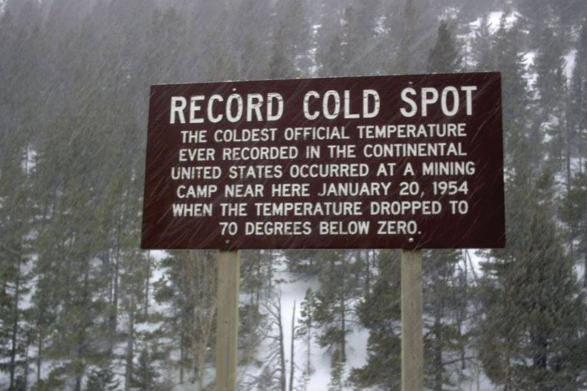
Conditions at this site, located at an elevation of 5,470 feet, were then ideal for maximal radiational cooling. Seven days of virtually continuous snowfall had increased snow depth from 8 inches to 66 inches. After peaking at -18°F on January 19th, the skies cleared, winds subsided, and the temperature plummeted. At approximately 2 a.m., H. M. Kleinschmidt, an NWS cooperative observer, recorded exceptionally low temperature readings from his personal and official thermometers. The Weather Bureau’s Instrument Division later tested the accuracy and performance of both devices; their analysis revealed that a new record (-69.7°F) had been set at Rogers Pass. University of Montana researchers Rick and Susie Graetz conclude, however, that “there's a good chance that, by 6 a.m., it was significantly colder. So, we were close to and may have even tied the U.S. national record of minus 80 established at Fort Yukon in Alaska.”
Such bitterly cold temperatures were occasionally matched or even surpassed by the speed and magnitude of temperature changes that occurred immediately before these record-breaking observations. On Christmas Eve, 1924, conditions at Fairfield, located near Freezeout Lake, changed from shirtsleeve to buffalo-robe weather in 12 hours, during which the temperature dropped from 63°F at noon to -21°F by midnight. This 84-degree difference is the most precipitous plunge in temperature recorded for a comparable time period in the United States. However, on January 23-24, 1916, Browning experienced the most severe temperature drop recorded anywhere on earth, when the temperature plummeted precisely 100 degrees, from 44°F to -56°F, in approximately 18 hours.
So, how does the natural world respond to rapid onset of extremely cold weather? Ralph Waldt, the author of Crown of the Continent, provides richly detailed insights on this matter. While he was encamped at an alpine lake in a remote portion of Glacier National Park, the temperature plunged from 34°F to -35°F in eight hours.
Awestruck, Waldt listened intently to the “phenomenal symphony” of sounds produced as ice formed rapidly over the lake’s surface. “The ice groaned, squealed, popped [and moaned. It literally] sang its way across that wild, pure-watered lake.” Ice formation also created “deep, high-pitched, undulating sounds, powerful, vibrating expansion cracks, [indeed] an extraordinary array of sound that can only be described as extraterrestrial.”
Powerful winds batter the Rocky Mountain Front from November through February. According to Karl Puckett, a columnist for the Great Falls Tribune, wind speeds in this area exceeded 75 mph on 80 different occasions during the 2011-2012 season, with gusts surpassing 100 mph on 11 instances. The state record, a 143-mph gust, was clocked on February 21, 2002, at the Miller Colony, located 10 miles northwest of Choteau.
Chinook winds provide a welcome respite from the bitterly cold winter weather for which Montana is historically renowned. Generated when westerlies, then devoid of moisture, crest the Continental Divide, Chinooks are channeled down through mountain passes onto the high plains, thereby warming air at the rate of approximately 5.5°F per thousand feet of elevation loss. Chinook conditions can persist for days, but their onset is often marked by incredibly swift temperature changes.
According to Christopher Burt, author of Extreme Weather, the temperature at Kipp, Montana, rose 80°F in roughly 15 hours on December 1, 1896, thus “entirely melting 30″ of snow.” On January 11, 1980, the temperature at Great Falls International Airport soared from -32°F to 15°F in only seven minutes, which remains the most rapid temperature change recorded in American history. These events, however, are surpassed in magnitude by the world-record 103°F temperature change observed at Loma in 1972, when Chinook winds triggered a meteoric rise from -54°F, at 9 a.m. on January 14th, to 49°F by 8 a.m. on January 15th.
Old Man Winter does not currently pack quite the punch that he did during the 19th century, but Montana winters can still generate record-breaking performances. The maximum snowfall reported in 24 hours is 48 inches, which occurred most recently at an observational station southeast of Millegan on December 27, 2003. Similarly, the largest single-storm snowfall, 77.5 inches, was measured at Summit, near East Glacier Park, on January 17-20, 1972.
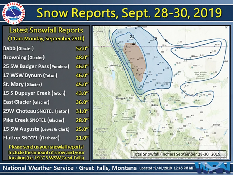
An unseasonably early storm bombarded the northern Rocky Mountain Front from September 28-30, 2019. Babb and Browning received 52″ and 48″ of snow, respectively. As predicted by its preceding Winter Storm Watch, this event “set a new benchmark for snow accumulations,” one for which the only known precedent was a storm in 1934.
Montana’s newest national record was established on October 25, 2020. According to the Missoula NWS office, the overnight low (-29°F) at Potomac was the coldest temperature ever reported “at an official climate site anywhere in the [contiguous] United States so early in the season.”
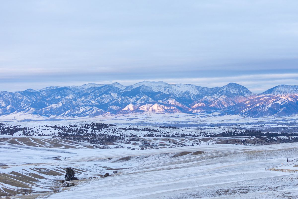
These data raise an obvious question: Why do extreme winter weather events occur with such frequency and ferocity in Montana? Among contributing factors, three are particularly noteworthy. Unlike mountain ranges in Europe and Asia, the Rockies’ north-to-south orientation poses no impediment to the collision of Arctic air from the north and tropical air masses from the south. Consequently, Dr. Dewey concludes that the ingredients for “violent and rapidly changing weather conditions are brought into direct conflict throughout the year, [which makes] the Western United States the world leader in many types of severe weather.”
Meteorologist Mike Heard notes that our proximity to the Pacific Northwest “places Montana relatively close to the [crosshairs of storms that emanate from] the Pacific Ocean and Gulf of Alaska.” Rick Dittmann, a meteorologist formerly stationed at Great Falls, emphasizes the position of the mid-latitude jet stream, the “highway upon which storms are usually transported, [as] largely responsible for the extreme weather” that is a hallmark of Montana winters.
The Rocky Mountain Front is unquestionably the epicenter at which these climate drivers most frequently produce outbursts of extreme winter weather. In his masterpiece, This House of Sky, Ivan Doig recounts the awe, respect, and foreboding that he initially experienced upon relocation to this area: “In front of us now loomed the reef-line of the entire continent, where the surf of weather broke and came flooding across. [B]oth of us knew what could be ahead when full winter poured down off these north peaks.”
Given the multitude of extreme weather events that are chronicled in the annals of Montana history, another intriguing question comes to mind. Were such events more common and even more severe during the Little Ice Age, which arguably was the coolest and wettest period since the end of the Pleistocene? That question cannot be answered definitively. However, for readers whose curiosity may be piqued by this topic, stay tuned. I am currently preparing a manuscript on the environmental and cultural impact of the Little Ice Age (ca. 1500-1850) in Montana.


Leave a Comment Here